Table of Contents
Understanding Cut and Fill Calculations in Earthwork
Cut and fill calculations are the backbone of site grading. Whether you’re shaping a commercial pad or preparing a roadbed, knowing how much dirt to move—and where—is essential. These calculations help determine how to level a site efficiently, reduce hauling costs, and meet grading requirements without surprises. Using cut and fill calculations early in the planning phase also helps avoid surprises during construction.
Contractors and estimators rely on these calculations not just to plan, but to forecast project needs and minimize risk. A balanced site reduces trips, labor hours, and material waste. Even on smaller jobs, a few hundred cubic yards off-target can turn a profitable bid into a costly one.

What Do Cut and Fill Mean?
- Cut is the removal of earth to lower an area.
- Fill is the addition of earth to raise an area.
- Accurate cut and fill calculations help contractors balance the site—reducing excess material or the need to bring in additional dirt. This balance improves efficiency and lowers costs.
- For instance, a pad that’s too high may require thousands of cubic yards of fill that weren’t budgeted. A pad that’s too low might result in overcutting and wasted export. Getting this right is vital for both budget and build quality.
Step-by-Step Guide to Performing Cut and Fill Calculations
Using clear steps and proven methods, cut and fill calculations provide contractors with the data needed to plan grading operations and manage earthwork volumes.
1. Compare Existing vs. Proposed Grades
Start with the grading plan. Overlay the existing ground elevations with the proposed finish elevations. This reveals where cuts or fills are needed.
When evaluating existing vs. proposed grades, also check for inconsistencies in the plans. Some grading sheets may include profiles or cross sections—use these to double-check transitions and spot potential grading challenges.
2. Break the Site into Grid Squares
Divide the site into equal grid sections—common sizes include 50×50 or 100×100 feet. Smaller grids give more precise volume data.
On tighter sites or for detailed areas like building pads and parking lots, you might use 25×25 or even 10×10 grids. The goal is to strike a balance between calculation accuracy and processing time.
3. Determine Elevation Differences at Grid Corners
At each grid point, subtract existing grade from proposed grade:
- Positive = fill
- Negative = cut
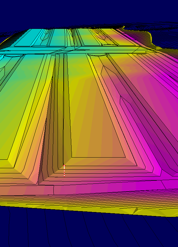
This helps visualize material movement across the entire site. Many estimators use color-coded maps for quick reference—blue for fill, red for cut. These visuals can make it easier to communicate the scope of earthwork with your team or your client.
4. Apply the Average-End Area Method
This standard approach uses the average of elevation differences at grid points to determine volumes:
Formula:
(Average Elevation Difference) x (Area of Grid) ÷ 27 = Cubic Yards
This gives a quick approximation of the earthwork volume for each grid cell. It’s not as exact as full 3D surface-to-surface comparison, but it’s fast, field-tested, and widely accepted.
5. Add Up All Volumes
Total the cut volumes and the fill volumes separately. This will tell you if your site balances or if you’ll need to haul material in or out. A solid set of cut and fill calculations gives you a clear picture of material movement across the site and helps prevent unexpected costs.
A balanced site doesn’t always mean zero difference—it means managing dirt efficiently. Some loss is expected in stripping and compaction, so plan for shrink/swell factors during your calculations.

Tools That Improve Cut and Fill Calculations Accuracy
To get the most from your cut and fill calculations, use the right tools:
- GPS rover or total station to verify site topography
- Civil design software like AGTEK, Civil 3D, or Carlson
- Reference spot elevations and benchmarks
Accurate tools ensure your cut and fill calculations reflect real-world conditions. Survey-grade instruments and modern software eliminate guesswork and help contractors build confidence in their bids and timelines.
Drone data, point clouds, and LiDAR scans are also being used more frequently to improve surface modeling before and after grading. These technologies give a clearer picture of actual conditions and help validate your takeoff.
Common Pitfalls in Cut and Fill Calculations
- Soil shrink and swell: Dirt expands when excavated and shrinks when compacted. Account for this.
- Topsoil stripping: Exclude topsoil from cut/fill estimates unless it’s being reused.
- Pavement and pad depths: Include these in your final elevations to get true earthwork needs.
- Plan gaps or missing detail: Don’t assume—it’s better to clarify with the engineer.
- Inaccurate spot grades: Double-check benchmark references to ensure you’re working from the right elevations.
Even the best software can’t fix bad input. If the base data is wrong, your cut and fill calculations will be off—sometimes drastically.
Why Cut and Fill Calculations Matter
Mistakes in earthwork estimates can cost thousands in unplanned trucking, delays, or rework. Solid cut and fill calculations:
- Help win competitive bids
- Reduce material waste
- Prevent surprises in the field
- Improve communication with grading and utility crews
Whether you’re preparing estimates, planning grading, or verifying design intent, cut and fill calculations play a critical role in successful project delivery.
They also tie directly into GPS machine control modeling. If you’re using automated equipment, your takeoff becomes the blueprint for every pass that machine makes. Precision here equals performance in the field.
Real-World Example: Small Error, Big Cost
On a recent commercial site, the initial grading estimate failed to account for a 6-inch overbuild on the parking lot. That slight oversight led to 300 extra cubic yards of fill being trucked in at the last minute—costing the contractor over $12,000 in material and haul fees. This kind of mistake is avoidable with solid cut and fill calculations.

Let TCL Consulting Help
At TCL Consulting, we specialize in construction takeoff services with a focus on accurate cut and fill calculations. Whether you’re bidding a subdivision or prepping a commercial pad, we give you the numbers you can count on.
We work directly from your plans to deliver:
- Earthwork volumes
- Cut/fill maps
- Site grading estimates
- 3D machine control models (if needed)
You’ll know exactly what dirt needs to move, where it’s going, and what it’ll cost.
Contact Us to learn more and get a quote today.