Table of Contents
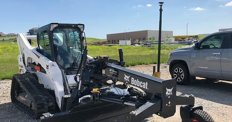
Precision grading has always been a cornerstone of successful construction projects. With the advancement of GPS grading systems for skid steers and dozers, contractors now have access to tools that significantly improve accuracy, reduce project timelines, and save costs. These systems, which integrate satellite-based technology and 3D terrain modeling, have redefined the way earthmoving tasks are executed. Let’s dive into how GPS grading systems work, their evolution, and why they are indispensable for modern construction.
The Evolution of GPS in Construction
When GPS technology first debuted in construction, it was primarily used on motor graders and dozers to ensure precise grading and reduce the reliance on traditional stakes and lasers. In the early 2000s, contractors began to adopt this technology, recognizing its potential to improve efficiency and accuracy. Over time, advancements such as real-time kinematic (RTK) positioning and the introduction of GPS grade-management systems have expanded its applications, from site surveying to complex grading tasks.
Today, GPS is no longer limited to grading tasks. Modern systems now support excavators, scrapers, and compactors, enabling contractors to dig trenches, balance sites, and even cut complex contours with millimeter-level precision. These advancements have revolutionized earthmoving by reducing rework, improving safety, and increasing operator productivity.

What Are GPS Grading Systems?
GPS grading systems are advanced technologies that combine satellite positioning, sensors, and data-driven designs to guide construction equipment. These systems allow operators to see their machine’s position in real-time and adjust accordingly, ensuring precise cuts, fills, and grading tasks. The integration of 3D digital terrain models (DTMs) provides detailed guidance, eliminating much of the guesswork traditionally involved in site preparation.
How Do They Work?
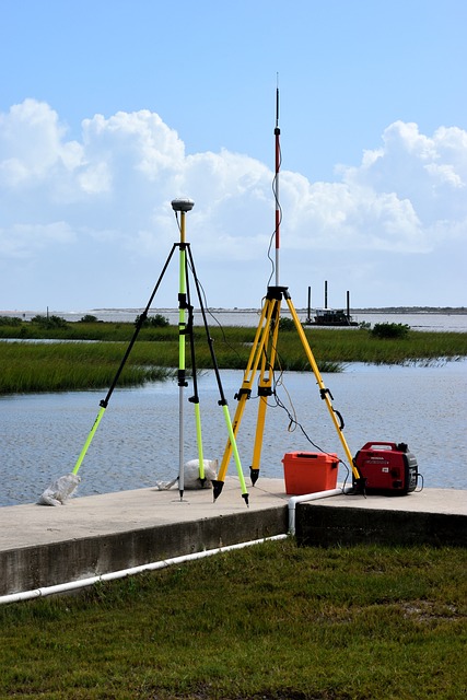
A GPS grading system operates through two primary components: the GPS segment and the control segment. The GPS segment determines the machine’s location on the site using satellite signals corrected by RTK data from a base station. The control segment involves an electronic 3D model of the jobsite, which provides precise grade information. Operators can use this data in “indicate” mode, where they manually guide the machine, or in “automatic” mode, where the system adjusts the machine’s hydraulics to maintain the desired grade.

Types of GPS Grading Systems
- 2D Grading Systems:
- Suitable for simpler projects like flat surfaces or consistent slopes.
- Utilizes lasers or sonic tracers to guide elevation changes.
- Cost-effective and ideal for smaller jobs.
- 3D Grading Systems:
- Designed for complex grading tasks with variable elevations and contours.
- Uses GPS and 3D models to achieve millimeter-level accuracy.
- Essential for large-scale projects where precision is critical.
Benefits of GPS Grading Systems
GPS grading systems provide numerous advantages, including:
- Increased Productivity: Operators spend less time reworking grades, allowing projects to be completed faster.
- Improved Accuracy: Achieve precise cuts and fills, reducing material waste and ensuring better project outcomes.
- Enhanced Safety: Fewer people are required on-site, minimizing exposure to heavy machinery.
- Cost Savings: Lower fuel consumption, reduced material waste, and fewer surveyor visits translate to significant savings.
- Adaptability: These systems are versatile, suitable for everything from road construction to site balancing.
Applications Beyond Grading
Modern GPS systems are not limited to grading tasks. Contractors use GPS-enabled excavators to dig trenches with exact slopes and depths, reducing the need for manual checks. These systems also excel at:
- Topographical Surveys: Quickly survey a new jobsite and compare results to site plans.
- Utility Locating: Record and relocate buried utilities with ease.
- Complex Contouring: Create culverts, retaining ponds, and pads without the need for additional machines.
Popular GPS Grading Systems
Some of the most trusted systems in the industry include:
- Trimble Earthworks GO!: A user-friendly system ideal for skid steers and compact equipment.
- Topcon 3D-MC: A high-performance system designed for intricate designs and large-scale projects.
- Leica Geosystems’ Grade Management Solutions: Known for their accuracy in grade checking and surveying.
Making the Investment in GPS Grading Systems
While the upfront cost of GPS grading systems may seem steep, the return on investment is substantial. Contractors can save time, reduce costs, and improve project outcomes with fewer mistakes and faster turnaround times. Additionally, these systems’ scalability means you can start with basic configurations and upgrade as your business grows.
Conclusion
GPS grading systems have revolutionized the construction industry by providing tools that enhance precision, efficiency, and safety. Whether you’re managing a small residential project or a large commercial development, these systems can help you achieve better results while saving time and money. As technology continues to evolve, investing in GPS grading systems is no longer a luxury but a necessity for staying competitive in today’s construction landscape.
Ready to take your projects to the next level? Contact us today to learn how GPS grading systems can transform your operations.
