
If you are pricing a GPS grading system for dozer work, you have probably sat through a demo already: a base station, a receiver or two, a display with a colored cut/fill map, and a price that made you set your coffee down. What the demo skips is how the system actually gets used on a dirt job, and what has to be true before your operator trusts the screen enough to stop asking for stakes.
This is not another components rundown. If you want the plain-English version of satellites, bases, and corrections, start with the GPS grading systems primer. This post stays on the dozer: how the receivers mount, how rough and finish passes differ, when the model replaces staking, and why the file loaded in the cab decides whether any of it pays off. For context on who is talking: I started in the field as a pipe layer in 2013 and moved to building takeoffs and machine-control models a few years later; my files have run on projects in 42 of the 50 states.
Why the dozer gets grade control first
If you only automate one machine, make it the dozer. The excavator digs to a mark and moves on. The motor grader shows up for a few weeks near the end, if you own one at all. The dozer is there from the first topsoil strip to the last finish pass, and it moves more material across more phases than anything else in the fleet. A dozer GPS system touches nearly every yard on the job.
There is a second reason. A dozer on automatics holds finish tolerances on dirt that used to require a grader. Plenty of contractors now strip, rough, and finish pads, slopes, and ditch lines with one machine and one operator. That is one less mobilization and one less seat to fill.
Mast-mounted vs. integrated receivers
Every major grade-control platform sells the dozer package two ways, and the difference matters more on a dozer than on any other machine because of where a dozer works.
Masts on the blade
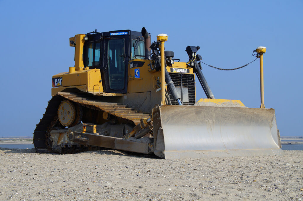
The traditional setup puts one or two receivers on masts bolted to the blade, so position is measured right at the cutting edge. Mast kits retrofit onto almost any dozer with healthy hydraulics, and they can move between machines if you keep brackets on the fleet. The downside is exposure. Masts and cables live in the worst spot on the machine — under limbs, next to structures, in front of everything the blade pushes. Crews pull the receivers every night so they do not walk off, and every mount and cable is a wear item.
Integrated, no masts
The newer setup puts the receivers on the cab roof and calculates the cutting edge with inertial sensors on the body and blade. Nothing sticks up off the blade to snag or get stolen, morning startup is faster, and the machine works under trees and around structures without babysitting hardware. It costs more, and it is generally married to that machine instead of floating around the fleet.
Calibrated and maintained, both setups hold comparable accuracy. The real decision points are the age of your iron, how rough your sites run, and how disciplined your crews are with cables and mounts. Retrofitting an older dozer usually means masts. Speccing a new machine, the integrated route is hard to argue against.
Rough passes and finish passes are different jobs
Most of the hours the system logs are rough passes, and most rough passes run indicate-only. The screen shows cut and fill to the surface, and the operator moves dirt in big, efficient pushes without over-cutting. That alone is worth money: the display keeps a green operator from digging past subgrade and handling the same material twice.
Finish passes are where the automatics earn their keep. The hydraulics hold the blade to the surface while the operator manages speed, track slip, and material, and the machine repeats a tolerance pass after pass that nobody sustains by feel for ten hours.
One habit separates crews that hold grade from crews that chase it: check the machine on a known point every morning. Cutting edges wear, masts get bumped, and a measure-up that was right in April is wrong by October. Two minutes, and it catches drift before drift becomes rework.
When the dozer and the model replace staking
With a 3D model in the cab, the whole site becomes the stake. The operator is not interpolating between hubs set fifty feet apart, and nobody waits on the grade crew to re-stake after a phase change or a washout. On mass grading and building pads, most daily staking simply goes away.
Be honest about what stays. Your surveyor still sets project control and localizes the site — the model builder never touches your control, and the localization is yours to own. Curb, structures, and critical layout still deserve stakes or at least a rover shot. And somebody should be checking grade behind the machine, especially in the first days on a new model. Machine control moves the grade information into the cab; it does not move the responsibility.
Phased surfaces: strip, subgrade, finish
This is where a lot of dozer models fall short. If the file in the cab is only the finish surface, the operator does offset math in his head all day — topsoil respread here, pavement section there, over-excavation in that corner. Mental offsets are where busts come from.
A dozer model built for production carries the phases as separate surfaces, so the operator picks the phase and grades to zero:
- A strip surface for topsoil removal, following the actual stripping plan instead of one flat assumption
- Subgrade surfaces for each section — a building pad, a paved lot, and a landscape island are three different offsets from finish
- Over-excavation and undercut zones where the geotech calls for them
- The finish surface, with a rough-grade surface behind it for the mass pushes
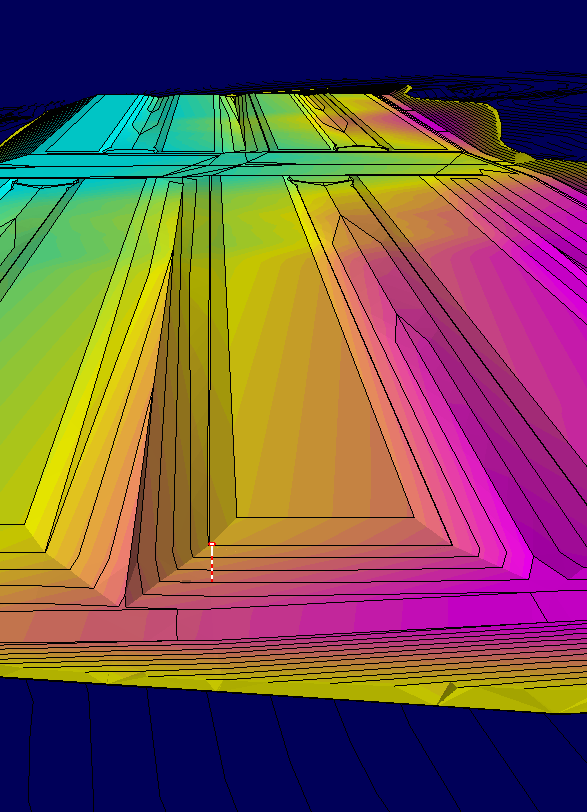
The phase logic should match your numbers. If the earthwork takeoff was built by phase, the model can follow it — the quantities the estimator bid become the surfaces the operator grades.
What actually gets loaded in the machine
A GPS grading system for dozer work is only as useful as the data loaded in it. A complete load usually looks like this:
- Design surfaces — finish, subgrade, and the phase surfaces above
- Alignments for roads and ditches, so the system reports station and offset
- Linework — curb, walls, utilities, striping, layout — in 2D or 3D, so the screen matches the sheet the foreman is holding
- Your localization file, which comes from your surveyor and stays with the site
One thing worth saying plainly: a real model is built from the engineer’s CAD and surface data. PDF plans alone are not enough to build a surface an automatic blade should trust. Ask for native design files at the pre-con, before you need them. A properly built machine-control model exports to every format the major grade-control platforms use, so the builder adapts to whatever your crews run — not the other way around.
The model decides whether the operator trusts the screen
Every operator gives the screen one honeymoon. The first time the model busts — a pad elevation that does not match the plans, curb linework in the wrong place — he goes back to asking for stakes, and the system spends the rest of the job as an expensive map display. It is almost never the hardware’s fault.
The fix happens before the surface is built. Every model I build starts with a document review: plans and specs read front to back for conflicts, missing spot elevations, contours that disagree with the grading notes, and scope gaps. Questions go to the GC or the engineer before the model is cut, not after the dozer finds the problem.
None of that removes your check. Shoot the first pads and the first stretch of subgrade with a rover. Plans can be wrong, models can be wrong, localization can be wrong — and a bust caught in the first hour costs nothing.
FAQ
Can I put a GPS grading system on an older dozer?
Yes. Mast-mounted kits retrofit onto most dozers with hydraulics in decent shape. Plenty of contractors start indicate-only — screen guidance without automatic blade control — and add the automatics valve kit once the crew is sold.
Do I still need a surveyor if the dozer has GPS?
Yes. Somebody has to set control, localize the site, and verify grade, and that stays on you. The model rides on top of your localization; it is not a substitute for it. Treat the rover check as part of the system, not a sign you distrust it.
What file format does my dozer need?
That depends on the platform your crews run, and it is the model builder’s problem, not yours. A competent builder delivers files for every format the major systems use. What the builder needs from you is the design data — current CAD and surface files from the engineer, not just the PDF set.
Will a dozer hold finish grade, or do I still need a grader?
On most dirt work — pads, slopes, ditches, respread — a dozer on automatics holds finish grade fine. Tight paving subgrade is the usual exception; many crews still put a trim pass on it. Material and operator matter as much as the receiver does.
The machine is half the purchase
The dealer sells you the iron and the receivers. What shows up on the screen comes from a model builder, and that half decides whether the operator ever trusts the system. That half is what I do. TCL Consulting is one person — me, Tony Lager, out of the Omaha area — building earthwork takeoffs and 3D machine-control models remotely for contractors nationwide. Every model includes the document review described above, and pricing is public: flat takeoff rates and an instant model calculator on the pricing page.
And when a machine refuses a file, remote GPS support exists for exactly that. Run your project through the calculator, or call (402) 708-1577 and talk to the guy who will actually build your file.

